
DJI Mavic 3 Multispectral Solution
DJI Mavic 3 Multispectral
DJI Mavic 3 Multispectral Drone. RGB + 4 multispectral cameras, RTK module, 43 minutes flight time. Ideal for agricultural production management, plant analysis and aerial measurement.
DJIMavic3Multispectral
DJI Mavic 3 Multispectral Drone. RGB + 4 multispectral cameras, RTK module, 43 minutes flight time. Ideal for agricultural production management, plant analysis and aerial measurement.

Key Features
Key Features
Foldable design for easy storage and portability anywhere. Safe operations with versatile obstacle avoidance. Ultra-long range capability with O3 transmission. 4 × 5MP G/R/RE/NIR spectral imaging. Centimeter-level RTK positioning and microsecond synchronization. Coverage area of up to 200 hectares per flight.
Multispectral+RGBImagingSystem
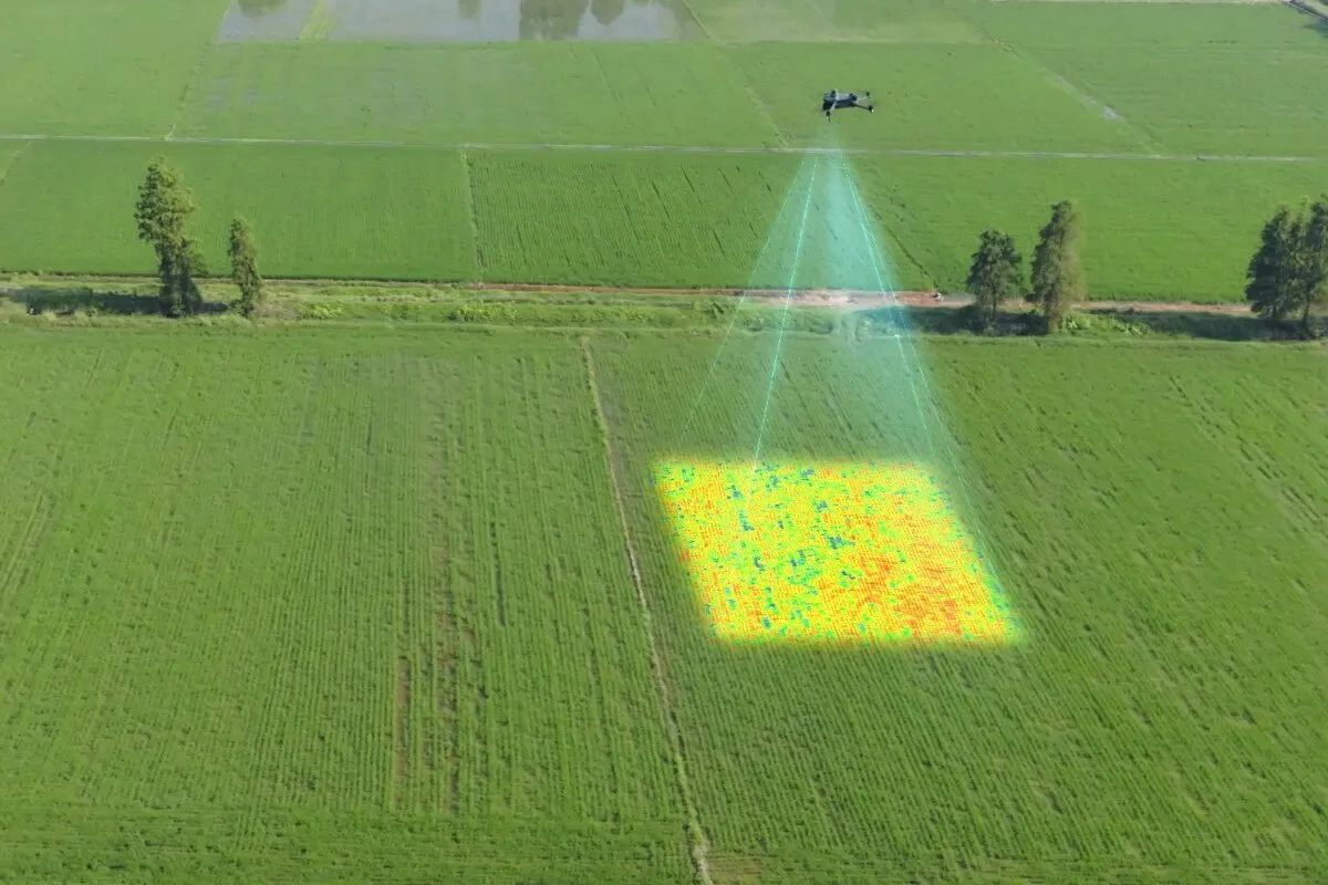
A new and upgraded imaging system with a 20MP RGB camera and four 5MP multispectral cameras (red, green, red-edge, and near-infrared). Enables applications such as high-precision aerial measurement, natural resource surveys, and crop growth monitoring.
SunlightSensor
The integrated sunlight sensor captures solar radiation and saves it to an image file, allowing for light compensation of image data during 2D reconstruction. This improves the accuracy and consistency of data over time, along with more accurate NDVI results. Features include: Automatic light compensation of image data; Enhanced accuracy in plant health analysis; Consistent data quality across different time periods.

RTKModule
Mavic 3 Multispectral with RTK module for centimeter-level positioning. Flight control, camera, and RTK module will synchronize within microseconds to accurately capture the position of each camera's imaging center. 1 cm + 1 ppm horizontal, 1.5 cm + 1 ppm vertical accuracy. Full synchronization of flight control, camera, and RTK module. No additional points required for high-precision aerial measurement.

StableSignal,SmoothImageTransmission.
O3 transmission integrates two transmitter signals and four receiver signals to support ultra-long transmission distances of 15 km. It ensures uninterrupted data transfer with strong signal quality.
Multi-faceted Obstacle Detection, Terrain Tracking Aerial Measurement
The aircraft is equipped with multiple wide FOV (Foot-Over) vision sensors that accurately detect obstacles in all directions to avoid multi-directional obstacles. Aerial surveying with terrain tracking can be easily performed on steep slopes. Features include: Accurate obstacle detection capability in all directions; Safe aerial surveying on steep slopes; 360-degree obstacle detection and avoidance system.
DJI TERRA
DJI Terra is a 3D modeling software based on photogrammetry technology. It supports the accurate and efficient reconstruction of various data and visible light using DJI LiDAR. DJI Terra is an ideal option for DJI Enterprise drones and accessories. Realistic 3D models can be created in three different resolutions (high, medium, and low) with DJI Terra. Water surfaces are automatically optimized using artificial intelligence technology. With just a single click, DJI Terra facilitates the high-accuracy processing of point cloud data captured by Zenmuse LiDAR. Multispectral data obtained from DJI Mavic 3 Multispectral and P4 Multispectral can be utilized to provide insights into plant growth and health, generating plant index maps such as NDVI and NDRE.
Box Contents
The DJI Mavic 3 Multispectral comes with all accessories ready for use. Main Product: DJI Mavic 3 Multispectral drone + RGB camera + 5 multispectral cameras + smart battery. Remote Control: DJI RC Pro Enterprise remote control. Accessories: Charger, power adapter, spare propeller set, carrying case. Documentation: User manual, technical specifications, safety guide, warranty certificate.
DJI Mavic 3 Multispectral with Bi-defense Guarantee
Optimize your agricultural production management with RGB and multispectral imaging, RTK sensitivity, and advanced data analysis. Our expert team is ready to offer you the most suitable solution. Benefit from professional support, technical service, and training services with Bisavunma's guarantee.
GetaQuote
Contact our team for detailed information and a tailored enterprise quote for DJI Mavic 3 Multispectral and our other solutions.