
DJI Zenmuse L2 Solution
DJI Zenmuse L2
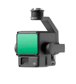
DJI Zenmuse L2 LiDAR scanning system. 3D mapping, high accuracy, IP54 protection. Ideal for mapping and measurement operations.
DJIZenmuseL2
DJI Zenmuse L2 LiDAR scanning system. 3D mapping, high accuracy, IP54 protection. Ideal for mapping and measurement operations.
Key Features
Technical Specifications
DJI Zenmuse L2 LiDAR system includes: LiDAR sensor, 3-axis gimbal, connection cables, power cable, data cable, mounting parts, protective case, user manual, technical specifications, safety guide, and warranty card.
Areas of Application
LiDAR technology is used in various mapping and measurement operations; high-precision 3D map creation; precise distance and height measurements; volume and area calculations in construction sites; and tree height and density analysis.
Box Contents
The DJI Zenmuse L2 comes with all accessories ready for use. Main Product: DJI Zenmuse L2 LiDAR system + advanced LiDAR sensor + 3-axis gimbal Connection: Gimbal mounting cables + power connector Accessories: Power cable, data cable, mounting parts, protective case Documentation: User manual, technical specifications, safety guide, warranty certificate
Enhance your mapping operations with DJI Zenmuse L2.
Contact us today for professional mapping solutions using advanced LiDAR technology.
GetaQuote
Contact our team for detailed information and a tailored enterprise quote for DJI Zenmuse L2 and our other solutions.